 vesseltracker.com
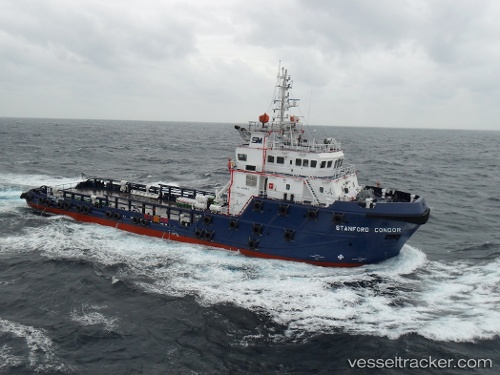
Vessel Stanford Condor IMO: 9589841, MMSI: 377042000 Offshore Tug Supply Ship
UTC, 28.36615, 49.67860, course: 329, speed: 9.5
UTC, 28.42193, 49.60291, course: 280, speed: 1.1
2026-01-18 16:13:25 UTC, 28.42153, 49.60215, course: 329, speed: 0
Live AIS position:
UTC. 37 nm S of Soroosh (Cyrus) Terminal),
updated 2026-01-18 16:13:25 UTC.
Find the position of the vessel Stanford Condor on the map. The latter are known coordinates and path.
marine traffic ship tracker show on live map
The current position of vessel Stanford Condor is 28.42153 lat / 49.60215 lng. Updated: 2026-01-18 16:13:25 UTCCurrently sailing under the flag of St Vincent Grenadines
Details:
Last coordinates of the vessel:
UTC, 28.35067, 49.69249, course: 176, speed: 0UTC, 28.36615, 49.67860, course: 329, speed: 9.5
UTC, 28.42193, 49.60291, course: 280, speed: 1.1
2026-01-18 16:13:25 UTC, 28.42153, 49.60215, course: 329, speed: 0