 vesseltracker.com
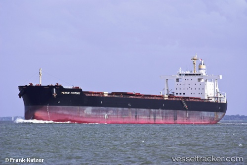
Vessel Venus History IMO: 9591600, MMSI: 209941000 Bulk Carrier
UTC, -31.92126, 152.99261, course: 24, speed: 4.2
UTC, -31.91237, 152.99915, course: 20, speed: 4.7
2026-01-17 19:45:26 UTC, -31.82520, 153.04381, course: 21, speed: 4.4
Live AIS position:
UTC. 16 nm SE of Laurieton),
updated 2026-01-17 19:45:26 UTC.
Find the position of the vessel Venus History on the map. The latter are known coordinates and path.
marine traffic ship tracker show on live map
The current position of vessel Venus History is -31.82520 lat / 153.04381 lng. Updated: 2026-01-17 19:45:26 UTCDetails:
Last coordinates of the vessel:
UTC, -32.18260, 152.83025, course: 29, speed: 8.4UTC, -31.92126, 152.99261, course: 24, speed: 4.2
UTC, -31.91237, 152.99915, course: 20, speed: 4.7
2026-01-17 19:45:26 UTC, -31.82520, 153.04381, course: 21, speed: 4.4