 vesseltracker.com
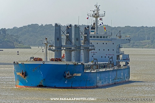
Vessel Aramis IMO: 9593359, MMSI: 538004630 Bulk Carrier
UTC, 29.57718, -93.67693, course: 210, speed: 0.1
UTC, 29.57327, -93.67896, course: 7, speed: 0.1
2026-01-17 05:24:33 UTC, 29.57275, -93.67873, course: 336, speed: 0.6
Live AIS position:
UTC. 14 nm SE of Sabine Pass),
updated 2026-01-17 05:24:33 UTC.
Find the position of the vessel Aramis on the map. The latter are known coordinates and path.
marine traffic ship tracker show on live map
The current position of vessel Aramis is 29.57275 lat / -93.67873 lng. Updated: 2026-01-17 05:24:33 UTCCurrently sailing under the flag of Marshall Is
Aramis built in 2012 year
Deadweight:
55830 tDetails:
Last coordinates of the vessel:
UTC, 29.57728, -93.67705, course: 206, speed: 0.2UTC, 29.57718, -93.67693, course: 210, speed: 0.1
UTC, 29.57327, -93.67896, course: 7, speed: 0.1
2026-01-17 05:24:33 UTC, 29.57275, -93.67873, course: 336, speed: 0.6