 vesseltracker.com
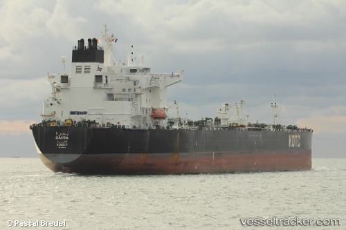
Vessel Bahra IMO: 9595008, MMSI: 447069000 Crude Oil Tanker
UTC, 50.63622, 0.60152, course: 245, speed: 14.9
UTC, 50.55726, 0.29269, course: 251, speed: 13.6
2026-01-18 18:22:29 UTC, 50.51962, 0.08165, course: 255, speed: 12.9
Live AIS position:
UTC. 15 nm S of Seaford),
updated 2026-01-18 18:22:29 UTC.
Find the position of the vessel Bahra on the map. The latter are known coordinates and path.
marine traffic ship tracker show on live map
The current position of vessel Bahra is 50.51962 lat / 0.08165 lng. Updated: 2026-01-18 18:22:29 UTCCurrently sailing under the flag of Kuwait
Bahra built in 2012 year
Deadweight:
110761 tDetails:
Last coordinates of the vessel:
UTC, 50.78303, 0.92417, course: 230, speed: 15.2UTC, 50.63622, 0.60152, course: 245, speed: 14.9
UTC, 50.55726, 0.29269, course: 251, speed: 13.6
2026-01-18 18:22:29 UTC, 50.51962, 0.08165, course: 255, speed: 12.9