 vesseltracker.com
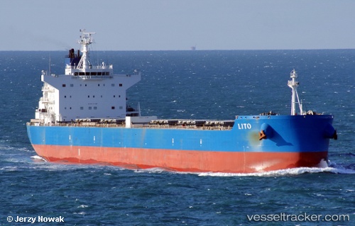
Vessel Lito IMO: 9601338, MMSI: 636015548 Bulk Carrier
UTC, 30.14064, 32.56995, course: 180, speed: 10.4
UTC, 29.83031, 32.54109, course: 215, speed: 6.2
2026-01-15 16:38:42 UTC, 29.81383, 32.52825, course: 213, speed: 5.4
Live AIS position:
UTC. Near Al Adabiyah),
updated 2026-01-15 16:38:42 UTC.
Find the position of the vessel Lito on the map. The latter are known coordinates and path.
marine traffic ship tracker show on live map
The current position of vessel Lito is 29.81383 lat / 32.52825 lng. Updated: 2026-01-15 16:38:42 UTCDetails:
Last coordinates of the vessel:
UTC, 30.34166, 32.38448, course: 143, speed: 10.7UTC, 30.14064, 32.56995, course: 180, speed: 10.4
UTC, 29.83031, 32.54109, course: 215, speed: 6.2
2026-01-15 16:38:42 UTC, 29.81383, 32.52825, course: 213, speed: 5.4