vessel LOVELY LEAH IMO: 9604770, Bulk Carrier vesseltracker.com
Vessel LOVELY LEAH IMO: 9604770, Bulk Carrier
MMSI: 538009863 callsign: V7A5265 size: 170x27

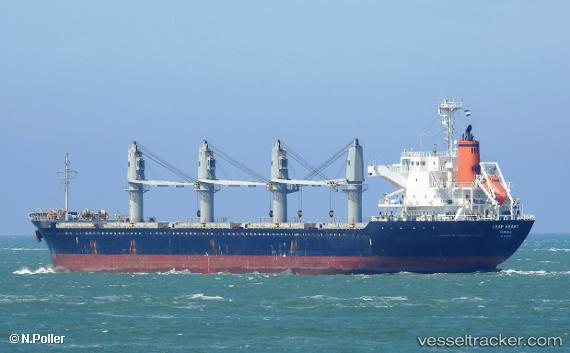
Find the position of the vessel LOVELY LEAH on the map. The latter are known coordinates and path.

marine traffic ship tracker show on live map

The current position of vessel LOVELY LEAH is 76.4918 lat / -75.5433 lng. Updated: 2025-07-16 03:18:38 UTC

Currently sailing under the flag of Marshall Islands

LOVELY LEAH built in 2012 year

Deadweight:
28383 t

Details:


Last coordinates of the vessel:
2025-07-16 03:18:38 UTC, 76.4918, -75.5433, course: 164, speed: 3.9


Most frequent ports a vessels calls at LOVELY LEAH (538009863):

Balboa, traffic: 4
Myrtle Grove, traffic: 4
Panama, traffic: 4
Algiers, traffic: 3
Burnside, traffic: 2
New Orleans, traffic: 2
Colon, traffic: 2
Ostrica, traffic: 2
Cristobal, traffic: 2
Good Hope, traffic: 2
Swinoujscie, traffic: 2
Manila, traffic: 1
Nouakchott, traffic: 1
Copenhagen, traffic: 1
Gibraltar, traffic: 1

Link to the map:


Find another ship

LOVELY_LEAH (538009863) last ports (portcalls and passsages)

Livorno | 2023-03-01 11:48:24
Algiers | 2023-02-07 08:26:37
Algiers | 2023-02-03 06:02:42
Algiers | 2023-01-30 06:00:18
Algeciras | 2023-01-28 14:32:17
Strait Of Gibraltar | 2023-01-28 08:39:31
Gibraltar | 2023-01-28 06:01:37
Huelva | 2023-01-27 11:10:07
Aviles | 2023-01-23 09:04:52
Kobenhavn | 2023-01-18 20:20:49
Swinoujscie | 2023-01-18 08:48:10
Swinoujscie | 2023-01-14 08:31:26
Manila | 2022-01-23 13:35:27
Panama | 2021-12-22 09:55:09
Panama | 2021-12-22 09:15:08
Balboa | 2021-12-22 05:25:09
Cristobal | 2021-12-20 15:30:24
Ostrica | 2021-12-15 09:00:02
Myrtle Grove | 2021-12-15 06:40:14
Burnside | 2021-12-04 04:46:00
Good Hope | 2021-12-04 00:50:17
New Orleans | 2021-12-03 21:47:34
Myrtle Grove | 2021-12-01 00:00:53
Nouakchott | 2021-09-30 15:47:35