 vesseltracker.com
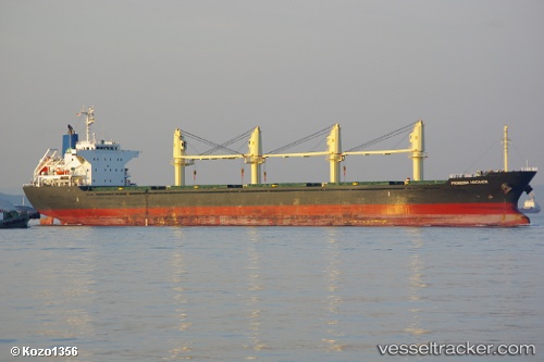
Vessel Prinsesa Maganda IMO: 9605059, MMSI: 373142000 Bulk Carrier
UTC, 29.62500, 128.43832, course: -1, speed: 11
UTC, 29.66302, 128.50768, course: 57, speed: 11.5
2026-01-17 11:56:17 UTC, 29.80667, 128.77834, course: -1, speed: 11
Live AIS position:
UTC. 104 nm N of Koniya),
updated 2026-01-17 11:56:17 UTC.
Find the position of the vessel Prinsesa Maganda on the map. The latter are known coordinates and path.
marine traffic ship tracker show on live map
The current position of vessel Prinsesa Maganda is 29.80667 lat / 128.77834 lng. Updated: 2026-01-17 11:56:17 UTCDetails:
Last coordinates of the vessel:
UTC, 29.48667, 128.18668, course: -1, speed: 11UTC, 29.62500, 128.43832, course: -1, speed: 11
UTC, 29.66302, 128.50768, course: 57, speed: 11.5
2026-01-17 11:56:17 UTC, 29.80667, 128.77834, course: -1, speed: 11