 vesseltracker.com
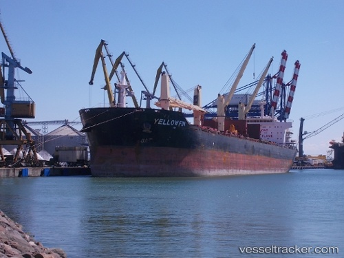
Vessel Yellow Fin IMO: 9607289, MMSI: 215887000 Bulk Carrier
UTC, 24.0383, -80.6733, course: -1, speed: 12
UTC, 24.4064, -80.0258, course: 57, speed: 12.2
2026-01-16 06:48:35 UTC, 24.5417, -79.7867, course: -1, speed: 11
Live AIS position:
UTC. 48 nm SE of Tavernier),
updated 2026-01-16 06:48:35 UTC.
Find the position of the vessel Yellow Fin on the map. The latter are known coordinates and path.
marine traffic ship tracker show on live map
The current position of vessel Yellow Fin is 24.5417 lat / -79.7867 lng. Updated: 2026-01-16 06:48:35 UTCCurrently sailing under the flag of Malta
Yellow Fin built in 2011 year
Deadweight:
56780 tDetails:
Last coordinates of the vessel:
UTC, 23.8083, -81.07, course: -1, speed: 11UTC, 24.0383, -80.6733, course: -1, speed: 12
UTC, 24.4064, -80.0258, course: 57, speed: 12.2
2026-01-16 06:48:35 UTC, 24.5417, -79.7867, course: -1, speed: 11