 vesseltracker.com
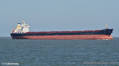
Vessel Naias IMO: 9611254, MMSI: 210102000 Bulk Carrier
UTC, 33.82784, 127.94481, course: 2, speed: 12.5
UTC, 33.91503, 127.98113, course: 8, speed: 12.6
2026-01-18 19:40:46 UTC, 34.32509, 127.97643, course: 35, speed: 11.2
Live AIS position:
UTC. 26 nm SW of Kukdo),
updated 2026-01-18 19:40:46 UTC.
Find the position of the vessel Naias on the map. The latter are known coordinates and path.
marine traffic ship tracker show on live map
The current position of vessel Naias is 34.32509 lat / 127.97643 lng. Updated: 2026-01-18 19:40:46 UTCCurrently sailing under the flag of Cyprus
Naias built in 2012 year
Deadweight:
81852 tDetails:
Last coordinates of the vessel:
UTC, 33.55058, 127.93825, course: 359, speed: 12.4UTC, 33.82784, 127.94481, course: 2, speed: 12.5
UTC, 33.91503, 127.98113, course: 8, speed: 12.6
2026-01-18 19:40:46 UTC, 34.32509, 127.97643, course: 35, speed: 11.2