 vesseltracker.com
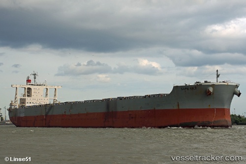
Vessel Cape Lily IMO: 9612430, MMSI: 566524000 Bulk Carrier
UTC, -27.65154, 10.97638, course: 139, speed: 8.4
UTC, -27.65847, 10.98289, course: 138, speed: 8.6
2026-01-19 00:29:09 UTC, -27.86215, 11.17530, course: 139, speed: 8
Live AIS position:
UTC. 225 nm W of Luderitz Bay),
updated 2026-01-19 00:29:09 UTC.
Find the position of the vessel Cape Lily on the map. The latter are known coordinates and path.
marine traffic ship tracker show on live map
The current position of vessel Cape Lily is -27.86215 lat / 11.17530 lng. Updated: 2026-01-19 00:29:09 UTCCurrently sailing under the flag of Singapore
Details:
Last coordinates of the vessel:
UTC, -27.51882, 10.86692, course: 140, speed: 8.4UTC, -27.65154, 10.97638, course: 139, speed: 8.4
UTC, -27.65847, 10.98289, course: 138, speed: 8.6
2026-01-19 00:29:09 UTC, -27.86215, 11.17530, course: 139, speed: 8