 vesseltracker.com
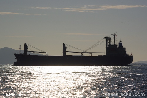
Vessel Hayabusa IMO: 9616008, MMSI: 354787000 General Cargo Ship
UTC, 9.20895, 99.88336, course: 0, speed: 0
UTC, 9.20895, 99.88336, course: 0, speed: 0
2026-01-17 01:29:10 UTC, 9.20892, 99.88336, course: 0, speed: 0
Live AIS position:
UTC. Near Khanom),
updated 2026-01-17 01:29:10 UTC.
Find the position of the vessel Hayabusa on the map. The latter are known coordinates and path.
marine traffic ship tracker show on live map
The current position of vessel Hayabusa is 9.20892 lat / 99.88336 lng. Updated: 2026-01-17 01:29:10 UTCCurrently sailing under the flag of Panama
Details:
Last coordinates of the vessel:
UTC, 9.20897, 99.88338, course: 0, speed: 0.1UTC, 9.20895, 99.88336, course: 0, speed: 0
UTC, 9.20895, 99.88336, course: 0, speed: 0
2026-01-17 01:29:10 UTC, 9.20892, 99.88336, course: 0, speed: 0