 vesseltracker.com
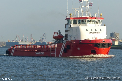
Vessel Statiaborg IMO: 9621534, MMSI: 245141000 Offshore Tug Supply Ship
UTC, 17.51623, -63.00770, course: 359, speed: 0.1
UTC, 17.51621, -63.00787, course: 359, speed: 0.1
2026-01-15 07:40:08 UTC, 17.51620, -63.00803, course: 357, speed: 0.2
Live AIS position:
UTC. Near Oranjestad),
updated 2026-01-15 07:40:08 UTC.
Find the position of the vessel Statiaborg on the map. The latter are known coordinates and path.
marine traffic ship tracker show on live map
The current position of vessel Statiaborg is 17.51620 lat / -63.00803 lng. Updated: 2026-01-15 07:40:08 UTCCurrently sailing under the flag of Netherlands
Statiaborg built in 2012 year
Deadweight:
867 tDetails:
Last coordinates of the vessel:
UTC, 17.51623, -63.00783, course: 358, speed: 0.3UTC, 17.51623, -63.00770, course: 359, speed: 0.1
UTC, 17.51621, -63.00787, course: 359, speed: 0.1
2026-01-15 07:40:08 UTC, 17.51620, -63.00803, course: 357, speed: 0.2