 vesseltracker.com
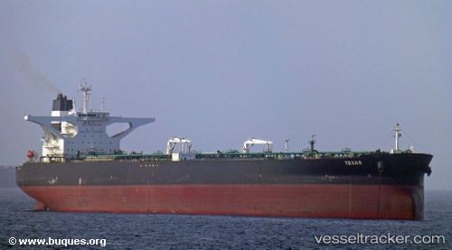
Vessel Texas IMO: 9623685, MMSI: 229132000 Crude Oil Tanker
UTC, 13.26167, 110.74667, course: -1, speed: 11
UTC, 13.26167, 110.74667, course: -1, speed: 11
2026-01-15 09:18:01 UTC, 13.57667, 110.74166, course: -1, speed: 11
Live AIS position:
UTC. 54 nm E of Tan Cang Qui Nhon),
updated 2026-01-15 09:18:01 UTC.
Find the position of the vessel Texas on the map. The latter are known coordinates and path.
marine traffic ship tracker show on live map
The current position of vessel Texas is 13.57667 lat / 110.74166 lng. Updated: 2026-01-15 09:18:01 UTCDetails:
Last coordinates of the vessel:
UTC, 13.03333, 110.74667, course: -1, speed: 11UTC, 13.26167, 110.74667, course: -1, speed: 11
UTC, 13.26167, 110.74667, course: -1, speed: 11
2026-01-15 09:18:01 UTC, 13.57667, 110.74166, course: -1, speed: 11