 vesseltracker.com
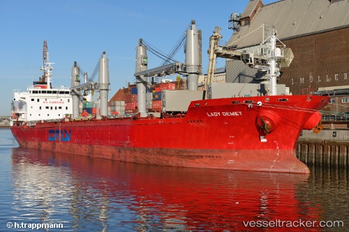
Vessel Lady Demet IMO: 9625592, MMSI: 538006903 Bulk Carrier
UTC, 59.76929, 28.41998, course: 323, speed: 0.1
UTC, 59.76929, 28.41998, course: 323, speed: 0.1
2026-01-18 15:45:17 UTC, 59.76929, 28.41998, course: 323, speed: 0.1
Live AIS position:
UTC. Near Ruch’I),
updated 2026-01-18 15:45:17 UTC.
Find the position of the vessel Lady Demet on the map. The latter are known coordinates and path.
marine traffic ship tracker show on live map
The current position of vessel Lady Demet is 59.76929 lat / 28.41998 lng. Updated: 2026-01-18 15:45:17 UTCCurrently sailing under the flag of Marshall Is
Lady Demet built in 2012 year
Deadweight:
30124 tDetails:
Last coordinates of the vessel:
UTC, 59.76929, 28.41998, course: 323, speed: 0.1UTC, 59.76929, 28.41998, course: 323, speed: 0.1
UTC, 59.76929, 28.41998, course: 323, speed: 0.1
2026-01-18 15:45:17 UTC, 59.76929, 28.41998, course: 323, speed: 0.1