 vesseltracker.com
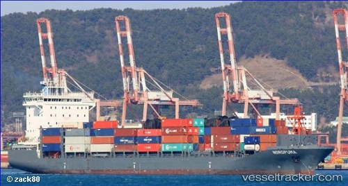
Vessel Nordpuma IMO: 9626259, MMSI: 212289000 Container Ship
UTC, 13.24500, -81.92333, course: -1, speed: 11
UTC, 13.41667, -81.88167, course: -1, speed: 10
2026-01-17 17:40:42 UTC, 13.80500, -81.81167, course: -1, speed: 11
Live AIS position:
UTC. 74 nm N of San Andrés),
updated 2026-01-17 17:40:42 UTC.
Find the position of the vessel Nordpuma on the map. The latter are known coordinates and path.
marine traffic ship tracker show on live map
The current position of vessel Nordpuma is 13.80500 lat / -81.81167 lng. Updated: 2026-01-17 17:40:42 UTCCurrently sailing under the flag of Cyprus
Details:
Last coordinates of the vessel:
UTC, 13.07333, -81.97167, course: -1, speed: 10UTC, 13.24500, -81.92333, course: -1, speed: 11
UTC, 13.41667, -81.88167, course: -1, speed: 10
2026-01-17 17:40:42 UTC, 13.80500, -81.81167, course: -1, speed: 11