 vesseltracker.com
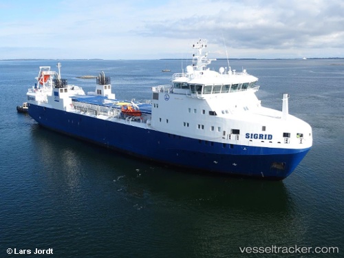
Vessel Sigrid IMO: 9631840, MMSI: 266416000 Nuclear Fuel Carrier
UTC, 58.60303, 18.57729, course: 216, speed: 11.1
UTC, 58.45250, 18.33447, course: 226, speed: 9.5
2026-01-17 02:52:48 UTC, 58.34061, 18.09382, course: 222, speed: 8.8
Live AIS position:
UTC. 34 nm SE of Studsvik),
updated 2026-01-17 02:52:48 UTC.
Find the position of the vessel Sigrid on the map. The latter are known coordinates and path.
marine traffic ship tracker show on live map
The current position of vessel Sigrid is 58.34061 lat / 18.09382 lng. Updated: 2026-01-17 02:52:48 UTCCurrently sailing under the flag of Sweden
Sigrid built in 2013 year
Deadweight:
1600 tDetails:
Last coordinates of the vessel:
UTC, 58.80608, 18.87251, course: 215, speed: 11UTC, 58.60303, 18.57729, course: 216, speed: 11.1
UTC, 58.45250, 18.33447, course: 226, speed: 9.5
2026-01-17 02:52:48 UTC, 58.34061, 18.09382, course: 222, speed: 8.8