 vesseltracker.com
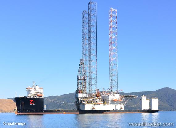
Find the position of the vessel Red Zed I on the map. The latter are known coordinates and path.
marine traffic ship tracker show on live map
The current position of vessel Red Zed I is 30.3641 lat / 32.3592 lng. Updated: 2025-06-30 10:11:49 UTCPort of registry:
Willemstad (capital city of Curaçao)Payload_mass:
51476 tonneGross tonnage:
37071Service entry:
2015-01-01T00:00:00ZDetails:
Last coordinates of the vessel:
UTC, 30.3642, 32.3593, course: 199, speed: 0UTC, 30.3642, 32.3593, course: 188, speed: 0.1
UTC, 30.3641, 32.3593, course: 156, speed: 0.1
2025-06-30 10:11:49 UTC, 30.3641, 32.3592, course: 152, speed: 0
The ship also appears on the maps: