 vesseltracker.com
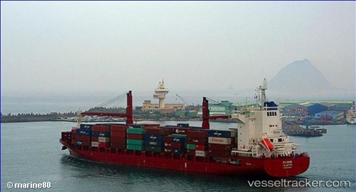
Vessel St.john IMO: 9634646, MMSI: 229949000 Container Ship
UTC, 12.73333, -71.72833, course: -1, speed: 15
UTC, 12.59333, -72.08500, course: -1, speed: 14
2026-01-17 11:24:24 UTC, 12.57011, -72.14023, course: 239, speed: 14.5
Live AIS position:
UTC. 21 nm NW of PUERTO BOLIVAR),
updated 2026-01-17 11:24:24 UTC.
Find the position of the vessel St.john on the map. The latter are known coordinates and path.
marine traffic ship tracker show on live map
The current position of vessel St.john is 12.57011 lat / -72.14023 lng. Updated: 2026-01-17 11:24:24 UTCDetails:
Last coordinates of the vessel:
UTC, 12.73742, -71.67634, course: 263, speed: 15.3UTC, 12.73333, -71.72833, course: -1, speed: 15
UTC, 12.59333, -72.08500, course: -1, speed: 14
2026-01-17 11:24:24 UTC, 12.57011, -72.14023, course: 239, speed: 14.5