 vesseltracker.com
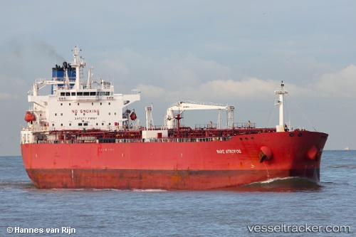
Vessel Nave Atropos IMO: 9638563, MMSI: 538005060 Crude Oil Tanker
UTC, 7.45439, 108.52072, course: 39, speed: 11.5
UTC, 7.85063, 108.88671, course: 39, speed: 11.3
2026-01-17 03:03:51 UTC, 7.96187, 108.98341, course: 35, speed: 11.5
Live AIS position:
UTC. 35 nm SE of Dai Hung (Tandem Load)),
updated 2026-01-17 03:03:51 UTC.
Find the position of the vessel Nave Atropos on the map. The latter are known coordinates and path.
marine traffic ship tracker show on live map
The current position of vessel Nave Atropos is 7.96187 lat / 108.98341 lng. Updated: 2026-01-17 03:03:51 UTCCurrently sailing under the flag of Marshall Is
Details:
Last coordinates of the vessel:
UTC, 7.26575, 108.37167, course: 37, speed: 12.2UTC, 7.45439, 108.52072, course: 39, speed: 11.5
UTC, 7.85063, 108.88671, course: 39, speed: 11.3
2026-01-17 03:03:51 UTC, 7.96187, 108.98341, course: 35, speed: 11.5