 vesseltracker.com
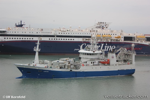
Vessel Ligrunn IMO: 9647784, MMSI: 258773000 Fish Carrier
UTC, 63.01094, 7.08315, course: 68, speed: 10.2
UTC, 63.08522, 7.46986, course: 49, speed: 11.2
2026-01-17 03:59:22 UTC, 63.19702, 7.84192, course: 60, speed: 11.2
Live AIS position:
UTC. Near Kristiansund),
updated 2026-01-17 03:59:22 UTC.
Find the position of the vessel Ligrunn on the map. The latter are known coordinates and path.
marine traffic ship tracker show on live map
The current position of vessel Ligrunn is 63.19702 lat / 7.84192 lng. Updated: 2026-01-17 03:59:22 UTCCurrently sailing under the flag of Norway
Ligrunn built in 2013 year
Deadweight:
600 tDetails:
Last coordinates of the vessel:
UTC, 62.90549, 6.76700, course: 34, speed: 11UTC, 63.01094, 7.08315, course: 68, speed: 10.2
UTC, 63.08522, 7.46986, course: 49, speed: 11.2
2026-01-17 03:59:22 UTC, 63.19702, 7.84192, course: 60, speed: 11.2