 vesseltracker.com
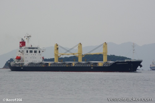
Vessel Glorious Earth IMO: 9652375, MMSI: 352946000 Bulk Carrier
UTC, 11.60121, 92.76693, course: 32, speed: 0.1
UTC, 11.60124, 92.76702, course: 34, speed: 0.1
2026-01-17 06:42:15 UTC, 11.60155, 92.76645, course: 53, speed: 0.1
Live AIS position:
UTC. Near Port Blair),
updated 2026-01-17 06:42:15 UTC.
Find the position of the vessel Glorious Earth on the map. The latter are known coordinates and path.
marine traffic ship tracker show on live map
The current position of vessel Glorious Earth is 11.60155 lat / 92.76645 lng. Updated: 2026-01-17 06:42:15 UTCDetails:
Last coordinates of the vessel:
UTC, 11.60132, 92.76681, course: 37, speed: 0UTC, 11.60121, 92.76693, course: 32, speed: 0.1
UTC, 11.60124, 92.76702, course: 34, speed: 0.1
2026-01-17 06:42:15 UTC, 11.60155, 92.76645, course: 53, speed: 0.1