 vesseltracker.com
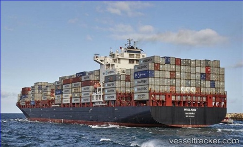
Vessel Wieland IMO: 9654464, MMSI: 255805563 Container Ship
UTC, 18.06800, -61.40117, course: 125, speed: 14.8
UTC, 17.87017, -61.15183, course: 128, speed: 14.9
2026-01-17 20:16:44 UTC, 17.62617, -60.85700, course: 128, speed: 14.7
Live AIS position:
UTC. 61 nm NE of Parham),
updated 2026-01-17 20:16:44 UTC.
Find the position of the vessel Wieland on the map. The latter are known coordinates and path.
marine traffic ship tracker show on live map
The current position of vessel Wieland is 17.62617 lat / -60.85700 lng. Updated: 2026-01-17 20:16:44 UTCCurrently sailing under the flag of Portugal
Details:
Last coordinates of the vessel:
UTC, 18.15917, -61.54817, course: 115, speed: 14.7UTC, 18.06800, -61.40117, course: 125, speed: 14.8
UTC, 17.87017, -61.15183, course: 128, speed: 14.9
2026-01-17 20:16:44 UTC, 17.62617, -60.85700, course: 128, speed: 14.7