 vesseltracker.com
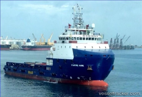
Vessel Stanford Hawk IMO: 9658159, MMSI: 376955000 Offshore Tug Supply Ship
UTC, 24.75514, 53.83814, course: 342, speed: 0.4
UTC, 24.75532, 53.83836, course: 285, speed: 0.2
2026-01-16 09:32:25 UTC, 24.75536, 53.83838, course: 335, speed: 0.5
Live AIS position:
UTC. 25 nm NE of Mubarraz Island),
updated 2026-01-16 09:32:25 UTC.
Find the position of the vessel Stanford Hawk on the map. The latter are known coordinates and path.
marine traffic ship tracker show on live map
The current position of vessel Stanford Hawk is 24.75536 lat / 53.83838 lng. Updated: 2026-01-16 09:32:25 UTCCurrently sailing under the flag of St Vincent Grenadines
Details:
Last coordinates of the vessel:
UTC, 24.75500, 53.83667, course: -1, speed: 0UTC, 24.75514, 53.83814, course: 342, speed: 0.4
UTC, 24.75532, 53.83836, course: 285, speed: 0.2
2026-01-16 09:32:25 UTC, 24.75536, 53.83838, course: 335, speed: 0.5