 vesseltracker.com
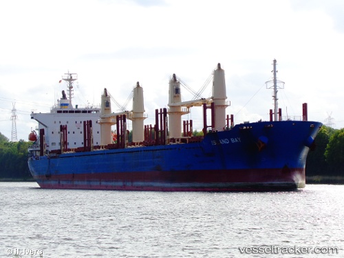
Vessel Island Bay IMO: 9663283, MMSI: 477694600 Bulk Carrier
UTC, -33.99304, 165.49911, course: 89, speed: 11.1
UTC, -33.98931, 165.95235, course: 89, speed: 11.3
2026-01-20 04:22:35 UTC, -33.98931, 165.95235, course: 89, speed: 11.3
Live AIS position:
UTC. 391 nm W of Whangaroa),
updated 2026-01-20 04:22:35 UTC.
Find the position of the vessel Island Bay on the map. The latter are known coordinates and path.
marine traffic ship tracker show on live map
The current position of vessel Island Bay is -33.98931 lat / 165.95235 lng. Updated: 2026-01-20 04:22:35 UTCDetails:
Last coordinates of the vessel:
UTC, -34.00145, 165.11443, course: 88, speed: 11.1UTC, -33.99304, 165.49911, course: 89, speed: 11.1
UTC, -33.98931, 165.95235, course: 89, speed: 11.3
2026-01-20 04:22:35 UTC, -33.98931, 165.95235, course: 89, speed: 11.3