 vesseltracker.com
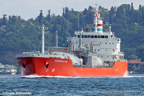
Vessel Kennington IMO: 9664926, MMSI: 566900000 Lpg Tanker
UTC, 29.01971, -89.34036, course: 34, speed: 11.7
UTC, 29.35304, -89.42015, course: 300, speed: 10.7
2026-01-17 13:55:26 UTC, 29.34553, -89.48383, course: 296, speed: 11.1
Live AIS position:
UTC. Near Ostrica),
updated 2026-01-17 13:55:26 UTC.
Find the position of the vessel Kennington on the map. The latter are known coordinates and path.
marine traffic ship tracker show on live map
The current position of vessel Kennington is 29.34553 lat / -89.48383 lng. Updated: 2026-01-17 13:55:26 UTCCurrently sailing under the flag of Singapore
Kennington built in 2013 year
Deadweight:
8556 tDetails:
Last coordinates of the vessel:
UTC, 28.75833, -89.39500, course: -1, speed: 12UTC, 29.01971, -89.34036, course: 34, speed: 11.7
UTC, 29.35304, -89.42015, course: 300, speed: 10.7
2026-01-17 13:55:26 UTC, 29.34553, -89.48383, course: 296, speed: 11.1