 vesseltracker.com
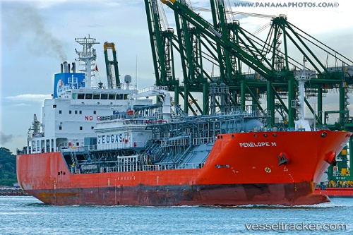
Vessel Penelope M IMO: 9676228, MMSI: 229645000 Lpg Tanker
UTC, 18.41615, -69.29354, course: 79, speed: 0.4
UTC, 18.41623, -69.29346, course: 93, speed: 0.2
2026-01-17 17:32:19 UTC, 18.41632, -69.29351, course: 85, speed: 0.2
Live AIS position:
UTC. Near San Pedro De Macoris),
updated 2026-01-17 17:32:19 UTC.
Find the position of the vessel Penelope M on the map. The latter are known coordinates and path.
marine traffic ship tracker show on live map
The current position of vessel Penelope M is 18.41632 lat / -69.29351 lng. Updated: 2026-01-17 17:32:19 UTCDetails:
Last coordinates of the vessel:
UTC, 18.41608, -69.29350, course: 90, speed: 0.3UTC, 18.41615, -69.29354, course: 79, speed: 0.4
UTC, 18.41623, -69.29346, course: 93, speed: 0.2
2026-01-17 17:32:19 UTC, 18.41632, -69.29351, course: 85, speed: 0.2