 vesseltracker.com
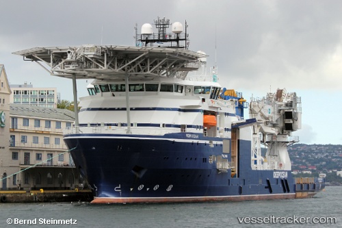
Vessel Normand Ocean IMO: 9678939, MMSI: 257291000 Offshore Support Vessel
UTC, 60.41168, 5.01764, course: 10, speed: 0
UTC, 60.41167, 5.01762, course: 10, speed: 0
2026-01-19 01:33:59 UTC, 60.41167, 5.01762, course: 10, speed: 0
Live AIS position:
UTC. Near Ågotnes),
updated 2026-01-19 01:33:59 UTC.
Find the position of the vessel Normand Ocean on the map. The latter are known coordinates and path.
marine traffic ship tracker show on live map
The current position of vessel Normand Ocean is 60.41167 lat / 5.01762 lng. Updated: 2026-01-19 01:33:59 UTCCurrently sailing under the flag of Norway
Normand Ocean built in 2014 year
Deadweight:
5520 tDetails:
Last coordinates of the vessel:
UTC, 60.41165, 5.01766, course: 10, speed: 0UTC, 60.41168, 5.01764, course: 10, speed: 0
UTC, 60.41167, 5.01762, course: 10, speed: 0
2026-01-19 01:33:59 UTC, 60.41167, 5.01762, course: 10, speed: 0