 vesseltracker.com
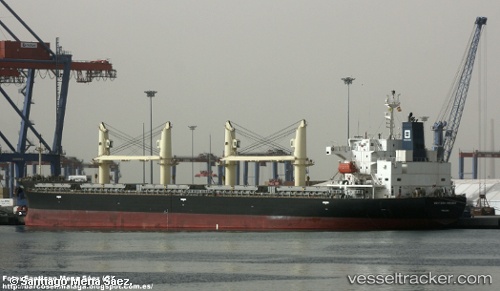
Vessel UNITY NORTH IMO: 9687136, MMSI: 311001070 Bulk Carrier
UTC, 18.14067, -94.41226, course: 200, speed: 0
UTC, 18.14063, -94.41228, course: 200, speed: 0
2026-01-18 14:45:57 UTC, 18.14066, -94.41226, course: 200, speed: 0
Live AIS position:
UTC. Near Coatzacoalcos),
updated 2026-01-18 14:45:57 UTC.
Find the position of the vessel UNITY NORTH on the map. The latter are known coordinates and path.
marine traffic ship tracker show on live map
The current position of vessel UNITY NORTH is 18.14066 lat / -94.41226 lng. Updated: 2026-01-18 14:45:57 UTCCurrently sailing under the flag of Bahamas
UNITY NORTH built in 2015 year
Deadweight:
37614 tDetails:
Last coordinates of the vessel:
UTC, 18.14063, -94.41227, course: 200, speed: 0UTC, 18.14067, -94.41226, course: 200, speed: 0
UTC, 18.14063, -94.41228, course: 200, speed: 0
2026-01-18 14:45:57 UTC, 18.14066, -94.41226, course: 200, speed: 0