 vesseltracker.com
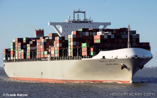
Vessel Mackinac Bridge IMO: 9689603, MMSI: 431241000 Container Ship
UTC, 9.43446, 107.21463, course: 142, speed: 9
UTC, 9.28136, 107.27359, course: 191, speed: 9.9
2026-01-18 17:14:15 UTC, 9.12913, 107.25542, course: 166, speed: 9.6
Live AIS position:
UTC. 51 nm NE of Ben Dam Con Dao Terminals),
updated 2026-01-18 17:14:15 UTC.
Find the position of the vessel Mackinac Bridge on the map. The latter are known coordinates and path.
marine traffic ship tracker show on live map
The current position of vessel Mackinac Bridge is 9.12913 lat / 107.25542 lng. Updated: 2026-01-18 17:14:15 UTCCurrently sailing under the flag of Japan
Details:
Last coordinates of the vessel:
UTC, 9.43446, 107.21463, course: 142, speed: 9UTC, 9.43446, 107.21463, course: 142, speed: 9
UTC, 9.28136, 107.27359, course: 191, speed: 9.9
2026-01-18 17:14:15 UTC, 9.12913, 107.25542, course: 166, speed: 9.6