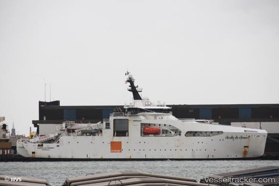
Find the position of the vessel Pierre De Fermat on the map. The latter are known coordinates and path.
marine traffic ship tracker show on live map
The current position of vessel Pierre De Fermat is 48.3824 lat / -4.47332 lng. Updated: 2025-01-18 18:03:45 UTCCurrently sailing under the flag of France
Cost:
60000000Home port:
Brest (port city in the Finistère department, Brittany, France)Port of registry:
Marseille (French commune in Bouches-du-Rhône, Provence-Alpes-Côte d'Azur; the second largest city of France)Speed:
12 knotPayload_mass:
4000 tonnePowered by:
diesel engine (internal combustion engine with quality rotational frequency governing, internal mixture formation, lean air-fuel-ratio, diffusion flame and compression ignition)Gross tonnage:
8781Beam:
21.5 metreOperator:
Orange Marine (French company specializing in laying submarine cables, Orange subsidiary)Service entry:
2014-10-25T00:00:00ZLocation of creation:
Vard Brattvaag (Ship yard)Named after:
Pierre de Fermat (French mathematician and lawyer)Manufacturer:
Vard Group (construction company in Ålesund, Norway)Owned:
Orange Marine (French company specializing in laying submarine cables, Orange subsidiary)Details:
Last coordinates of the vessel:
UTC, 48.3824, -4.47332, course: 9, speed: 0UTC, 48.3824, -4.47328, course: 9, speed: 0
UTC, 48.3824, -4.47328, course: 9, speed: 0
2025-01-18 18:03:45 UTC, 48.3824, -4.47332, course: 9, speed: 0