 vesseltracker.com
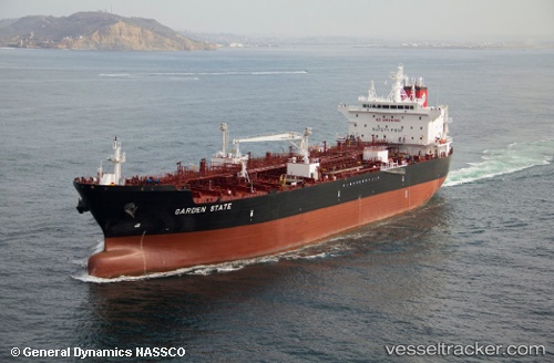
Vessel Garden State IMO: 9698006, MMSI: 367102000 Chemical Oil Products Tanker
UTC, 27.58448, -84.98044, course: 87, speed: 15.4
UTC, 27.59324, -84.13851, course: 90, speed: 14.7
2026-01-16 17:29:33 UTC, 27.59196, -83.53730, course: 90, speed: 14.6
Live AIS position:
UTC. 40 nm SW of Indian Rocks Beach),
updated 2026-01-16 17:29:33 UTC.
Find the position of the vessel Garden State on the map. The latter are known coordinates and path.
marine traffic ship tracker show on live map
The current position of vessel Garden State is 27.59196 lat / -83.53730 lng. Updated: 2026-01-16 17:29:33 UTCDetails:
Last coordinates of the vessel:
UTC, 27.58448, -84.98044, course: 87, speed: 15.4UTC, 27.58448, -84.98044, course: 87, speed: 15.4
UTC, 27.59324, -84.13851, course: 90, speed: 14.7
2026-01-16 17:29:33 UTC, 27.59196, -83.53730, course: 90, speed: 14.6