 vesseltracker.com
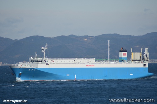
Vessel Asaka IMO: 9700201, MMSI: 431005691 Vehicles Carrier
UTC, 34.73763, 139.18832, course: 224, speed: 14.7
UTC, 34.53952, 138.98393, course: 229, speed: 13.9
2026-01-17 12:35:25 UTC, 34.51993, 138.85075, course: 270, speed: 13
Live AIS position:
UTC. Near Iruma),
updated 2026-01-17 12:35:25 UTC.
Find the position of the vessel Asaka on the map. The latter are known coordinates and path.
marine traffic ship tracker show on live map
The current position of vessel Asaka is 34.51993 lat / 138.85075 lng. Updated: 2026-01-17 12:35:25 UTCCurrently sailing under the flag of Japan
Details:
Last coordinates of the vessel:
UTC, 34.74030, 139.19144, course: 224, speed: 14.6UTC, 34.73763, 139.18832, course: 224, speed: 14.7
UTC, 34.53952, 138.98393, course: 229, speed: 13.9
2026-01-17 12:35:25 UTC, 34.51993, 138.85075, course: 270, speed: 13