 vesseltracker.com
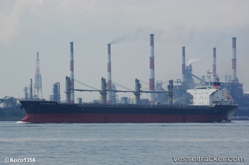
Vessel Eastern Hope IMO: 9700847, MMSI: 538005766 Bulk Carrier
UTC, 1.25134, 103.87422, course: 36, speed: 0.1
UTC, 1.25134, 103.87416, course: 38, speed: 0
2026-01-17 18:12:13 UTC, 1.25131, 103.87409, course: 38, speed: 0
Live AIS position:
UTC. Near Choa Chu Kang),
updated 2026-01-17 18:12:13 UTC.
Find the position of the vessel Eastern Hope on the map. The latter are known coordinates and path.
marine traffic ship tracker show on live map
The current position of vessel Eastern Hope is 1.25131 lat / 103.87409 lng. Updated: 2026-01-17 18:12:13 UTCDetails:
Last coordinates of the vessel:
UTC, 1.25131, 103.87420, course: 36, speed: 0UTC, 1.25134, 103.87422, course: 36, speed: 0.1
UTC, 1.25134, 103.87416, course: 38, speed: 0
2026-01-17 18:12:13 UTC, 1.25131, 103.87409, course: 38, speed: 0