 vesseltracker.com
Live AIS position:
45.94504° N, 124.71223° W UTC. 36 nm W of WARRENTON),
updated 2025-11-20 22:25:59 UTC.
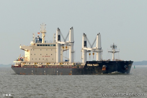
Find the position of the vessel Interlink Tenacity on the map. The latter are known coordinates and path.
marine traffic ship tracker show on live map
The current position of vessel Interlink Tenacity is 45.94504 lat / -124.71223 lng. Updated: 2025-11-20 22:25:59 UTCCurrently sailing under the flag of Marshall Is
Details:
Last coordinates of the vessel:
UTC, 45.63083, -125.34214, course: 20, speed: 11.3UTC, 45.80400, -125.01720, course: 57, speed: 10.9
UTC, 45.87206, -124.86548, course: 57, speed: 10.8
2025-11-20 22:25:59 UTC, 45.94504, -124.71223, course: 60, speed: 11.4