 vesseltracker.com
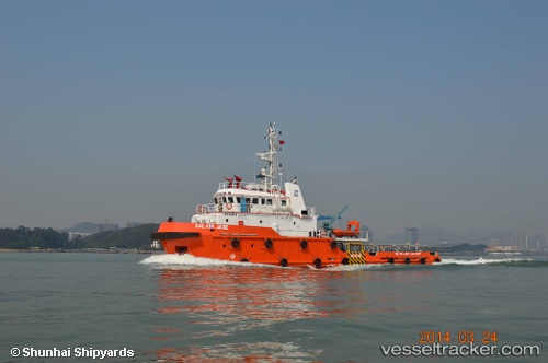
Vessel Mashhor 1 IMO: 9713129, MMSI: 508111266 Tug
UTC, 5.14470, 114.73600, course: 23, speed: 0.1
UTC, 5.14475, 114.73598, course: 36, speed: 0
2026-01-18 16:27:48 UTC, 5.14473, 114.73600, course: 42, speed: 0.1
Live AIS position:
UTC. 20 nm NW of Bandar Seri Begawan),
updated 2026-01-18 16:27:48 UTC.
Find the position of the vessel Mashhor 1 on the map. The latter are known coordinates and path.
marine traffic ship tracker show on live map
The current position of vessel Mashhor 1 is 5.14473 lat / 114.73600 lng. Updated: 2026-01-18 16:27:48 UTCDetails:
Last coordinates of the vessel:
UTC, 5.14470, 114.73600, course: 23, speed: 0.1UTC, 5.14470, 114.73600, course: 23, speed: 0.1
UTC, 5.14475, 114.73598, course: 36, speed: 0
2026-01-18 16:27:48 UTC, 5.14473, 114.73600, course: 42, speed: 0.1