 vesseltracker.com
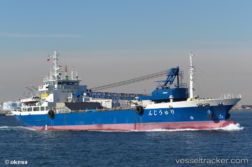
Vessel Ryujin IMO: 9714082, MMSI: 431004378 Aggregates Carrier
UTC, 36.27506, 140.89885, course: 351, speed: 11.5
UTC, 36.28017, 140.89771, course: 350, speed: 11.5
2026-01-17 15:00:39 UTC, 36.28017, 140.89771, course: 350, speed: 11.5
Live AIS position:
UTC. 16 nm SE of HITACHINAKA),
updated 2026-01-17 15:00:39 UTC.
Find the position of the vessel Ryujin on the map. The latter are known coordinates and path.
marine traffic ship tracker show on live map
The current position of vessel Ryujin is 36.28017 lat / 140.89771 lng. Updated: 2026-01-17 15:00:39 UTCDetails:
Last coordinates of the vessel:
UTC, 36.27506, 140.89885, course: 351, speed: 11.5UTC, 36.27506, 140.89885, course: 351, speed: 11.5
UTC, 36.28017, 140.89771, course: 350, speed: 11.5
2026-01-17 15:00:39 UTC, 36.28017, 140.89771, course: 350, speed: 11.5