 vesseltracker.com
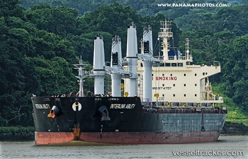
Vessel Interlink Ability IMO: 9714757, MMSI: 538005705 Bulk Carrier
UTC, 11.26500, 83.68167, course: -1, speed: 11
UTC, 11.15500, 83.64167, course: -1, speed: 11
2026-01-16 10:04:46 UTC, 11.10667, 83.62667, course: -1, speed: 11
Live AIS position:
UTC. 209 nm NE of Trincomalee),
updated 2026-01-16 10:04:46 UTC.
Find the position of the vessel Interlink Ability on the map. The latter are known coordinates and path.
marine traffic ship tracker show on live map
The current position of vessel Interlink Ability is 11.10667 lat / 83.62667 lng. Updated: 2026-01-16 10:04:46 UTCCurrently sailing under the flag of Marshall Is
Details:
Last coordinates of the vessel:
UTC, 11.59833, 83.80167, course: -1, speed: 11UTC, 11.26500, 83.68167, course: -1, speed: 11
UTC, 11.15500, 83.64167, course: -1, speed: 11
2026-01-16 10:04:46 UTC, 11.10667, 83.62667, course: -1, speed: 11