 vesseltracker.com
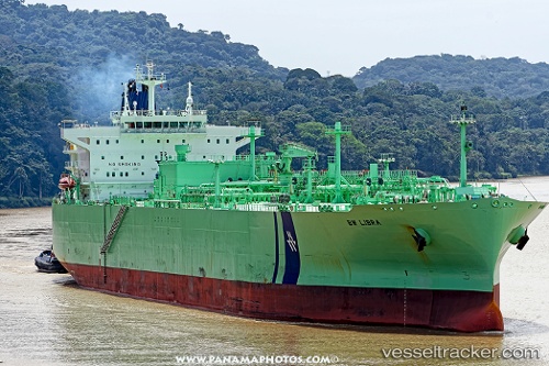
Vessel Bw Libra IMO: 9719496, MMSI: 235111639 Lpg Tanker
UTC, 10.66823, -98.52978, course: 283, speed: 15.5
UTC, 10.69167, -98.65333, course: -1, speed: 15
2026-01-16 17:46:59 UTC, 10.73333, -98.85667, course: -1, speed: 16
Live AIS position:
UTC. 327 nm SW of Puerto Ángel),
updated 2026-01-16 17:46:59 UTC.
Find the position of the vessel Bw Libra on the map. The latter are known coordinates and path.
marine traffic ship tracker show on live map
The current position of vessel Bw Libra is 10.73333 lat / -98.85667 lng. Updated: 2026-01-16 17:46:59 UTCCurrently sailing under the flag of United Kingdom
Details:
Last coordinates of the vessel:
UTC, 10.54517, -97.92491, course: 280, speed: 16.2UTC, 10.66823, -98.52978, course: 283, speed: 15.5
UTC, 10.69167, -98.65333, course: -1, speed: 15
2026-01-16 17:46:59 UTC, 10.73333, -98.85667, course: -1, speed: 16