 vesseltracker.com
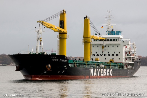
Vessel Sider Tayrona IMO: 9728849, MMSI: 374779000 General Cargo Ship
UTC, 29.73986, -95.28138, course: 325, speed: 0
UTC, 29.73985, -95.28137, course: 325, speed: 0
2026-01-16 06:17:24 UTC, 29.73986, -95.28137, course: 325, speed: 0
Live AIS position:
UTC. Near Houston),
updated 2026-01-16 06:17:24 UTC.
Find the position of the vessel Sider Tayrona on the map. The latter are known coordinates and path.
marine traffic ship tracker show on live map
The current position of vessel Sider Tayrona is 29.73986 lat / -95.28137 lng. Updated: 2026-01-16 06:17:24 UTCCurrently sailing under the flag of Panama
Details:
Last coordinates of the vessel:
UTC, 29.73984, -95.28137, course: 325, speed: 0UTC, 29.73986, -95.28138, course: 325, speed: 0
UTC, 29.73985, -95.28137, course: 325, speed: 0
2026-01-16 06:17:24 UTC, 29.73986, -95.28137, course: 325, speed: 0