 vesseltracker.com
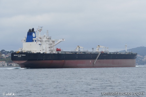
Vessel Seaways Hatteras IMO: 9730414, MMSI: 538007597 Crude Oil Tanker
UTC, 1.29833, 104.06559, course: 55, speed: 0
UTC, 1.29833, 104.06562, course: 54, speed: 0
2026-01-18 17:22:02 UTC, 1.29810, 104.06581, course: 43, speed: 0.1
Live AIS position:
UTC. Near TANAH MERAH),
updated 2026-01-18 17:22:02 UTC.
Find the position of the vessel Seaways Hatteras on the map. The latter are known coordinates and path.
marine traffic ship tracker show on live map
The current position of vessel Seaways Hatteras is 1.29810 lat / 104.06581 lng. Updated: 2026-01-18 17:22:02 UTCCurrently sailing under the flag of Marshall Is
Details:
Last coordinates of the vessel:
UTC, 1.29835, 104.06560, course: 55, speed: 0UTC, 1.29833, 104.06559, course: 55, speed: 0
UTC, 1.29833, 104.06562, course: 54, speed: 0
2026-01-18 17:22:02 UTC, 1.29810, 104.06581, course: 43, speed: 0.1