 vesseltracker.com
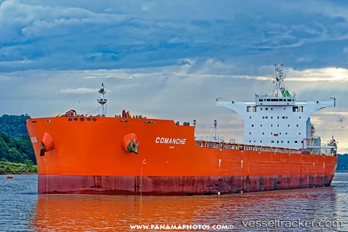
Vessel Comanche IMO: 9743289, MMSI: 538006933 Bulk Carrier
UTC, 16.63189, -159.81963, course: 114, speed: 9.8
UTC, 16.58851, -159.73526, course: 115, speed: 9.9
2026-01-19 19:20:41 UTC, 16.44854, -159.43590, course: 112, speed: 9.7
Live AIS position:
UTC. 272 nm SW of Captain Cook),
updated 2026-01-19 19:20:41 UTC.
Find the position of the vessel Comanche on the map. The latter are known coordinates and path.
marine traffic ship tracker show on live map
The current position of vessel Comanche is 16.44854 lat / -159.43590 lng. Updated: 2026-01-19 19:20:41 UTCCurrently sailing under the flag of Marshall Is
Details:
Last coordinates of the vessel:
UTC, 16.69496, -159.94672, course: 114, speed: 9.7UTC, 16.63189, -159.81963, course: 114, speed: 9.8
UTC, 16.58851, -159.73526, course: 115, speed: 9.9
2026-01-19 19:20:41 UTC, 16.44854, -159.43590, course: 112, speed: 9.7