 vesseltracker.com
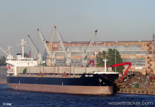
Vessel Sealady IMO: 9748734, MMSI: 249284000 Bulk Carrier
UTC, -32.47260, -50.82585, course: 43, speed: 12.7
UTC, -32.32466, -50.64834, course: 47, speed: 13.2
2026-01-16 10:08:03 UTC, -32.19824, -50.52320, course: 30, speed: 12.9
Live AIS position:
UTC. 65 nm SE of Tavares),
updated 2026-01-16 10:08:03 UTC.
Find the position of the vessel Sealady on the map. The latter are known coordinates and path.
marine traffic ship tracker show on live map
The current position of vessel Sealady is -32.19824 lat / -50.52320 lng. Updated: 2026-01-16 10:08:03 UTCCurrently sailing under the flag of Malta
Details:
Last coordinates of the vessel:
UTC, -32.81586, -51.27301, course: 46, speed: 12.1UTC, -32.47260, -50.82585, course: 43, speed: 12.7
UTC, -32.32466, -50.64834, course: 47, speed: 13.2
2026-01-16 10:08:03 UTC, -32.19824, -50.52320, course: 30, speed: 12.9