 vesseltracker.com
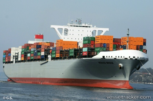
Vessel Monaco Bridge IMO: 9757204, MMSI: 353997000 Container Ship
UTC, 43.02014, -64.65495, course: 216, speed: 10.9
UTC, 42.94819, -64.71942, course: 214, speed: 10.9
2026-01-17 16:48:58 UTC, 42.73895, -64.90705, course: 218, speed: 11.4
Live AIS position:
UTC. 51 nm SE of Port La Tour),
updated 2026-01-17 16:48:58 UTC.
Find the position of the vessel Monaco Bridge on the map. The latter are known coordinates and path.
marine traffic ship tracker show on live map
The current position of vessel Monaco Bridge is 42.73895 lat / -64.90705 lng. Updated: 2026-01-17 16:48:58 UTCCurrently sailing under the flag of Panama
Details:
Last coordinates of the vessel:
UTC, 43.30039, -64.42274, course: 197, speed: 12.1UTC, 43.02014, -64.65495, course: 216, speed: 10.9
UTC, 42.94819, -64.71942, course: 214, speed: 10.9
2026-01-17 16:48:58 UTC, 42.73895, -64.90705, course: 218, speed: 11.4