 vesseltracker.com
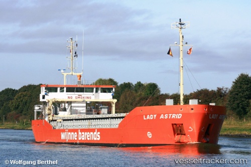
Vessel Lady Astrid IMO: 9760419, MMSI: 244020435 General Cargo Ship
UTC, 50.02002, -0.17143, course: 32, speed: 7.2
UTC, 50.02350, -0.16829, course: 31, speed: 7.2
2026-01-16 16:27:09 UTC, 50.13819, -0.06142, course: 22, speed: 7.8
Live AIS position:
UTC. 28 nm NW of Fecamp),
updated 2026-01-16 16:27:09 UTC.
Find the position of the vessel Lady Astrid on the map. The latter are known coordinates and path.
marine traffic ship tracker show on live map
The current position of vessel Lady Astrid is 50.13819 lat / -0.06142 lng. Updated: 2026-01-16 16:27:09 UTCDetails:
Last coordinates of the vessel:
UTC, 49.84885, -0.35608, course: 31, speed: 6.9UTC, 50.02002, -0.17143, course: 32, speed: 7.2
UTC, 50.02350, -0.16829, course: 31, speed: 7.2
2026-01-16 16:27:09 UTC, 50.13819, -0.06142, course: 22, speed: 7.8