 vesseltracker.com
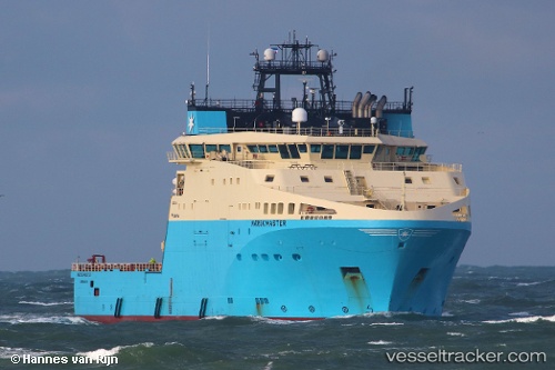
Vessel Maersk Master IMO: 9761035, MMSI: 219822000 Offshore Tug Supply Ship
UTC, -6.02110, 11.94686, course: 268, speed: 7.9
UTC, -6.01238, 11.82735, course: 271, speed: 8
2026-01-19 20:26:55 UTC, -6.00268, 11.70184, course: 271, speed: 7.9
Live AIS position:
UTC. 21 nm E of Armada Olombendo FPSO),
updated 2026-01-19 20:26:55 UTC.
Find the position of the vessel Maersk Master on the map. The latter are known coordinates and path.
marine traffic ship tracker show on live map
The current position of vessel Maersk Master is -6.00268 lat / 11.70184 lng. Updated: 2026-01-19 20:26:55 UTCCurrently sailing under the flag of Denmark
Details:
Last coordinates of the vessel:
UTC, -6.03148, 12.11772, course: 270, speed: 8.4UTC, -6.02110, 11.94686, course: 268, speed: 7.9
UTC, -6.01238, 11.82735, course: 271, speed: 8
2026-01-19 20:26:55 UTC, -6.00268, 11.70184, course: 271, speed: 7.9