 vesseltracker.com
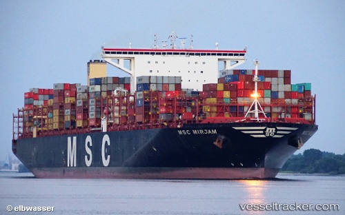
Vessel Msc Mirjam IMO: 9767376, MMSI: 636017684 Container Ship
UTC, 18.31336, 113.62386, course: 2, speed: 12.2
UTC, 18.64662, 113.64254, course: 5, speed: 9.2
2026-01-18 04:12:28 UTC, 18.78737, 113.65036, course: 13, speed: 8.9
Live AIS position:
UTC. 158 nm E of Honghai),
updated 2026-01-18 04:12:28 UTC.
Find the position of the vessel Msc Mirjam on the map. The latter are known coordinates and path.
marine traffic ship tracker show on live map
The current position of vessel Msc Mirjam is 18.78737 lat / 113.65036 lng. Updated: 2026-01-18 04:12:28 UTCCurrently sailing under the flag of Liberia
Details:
Last coordinates of the vessel:
UTC, 18.18888, 113.60121, course: 10, speed: 13.5UTC, 18.31336, 113.62386, course: 2, speed: 12.2
UTC, 18.64662, 113.64254, course: 5, speed: 9.2
2026-01-18 04:12:28 UTC, 18.78737, 113.65036, course: 13, speed: 8.9