 vesseltracker.com
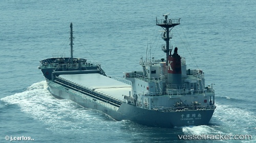
Vessel Chizukawa Maru IMO: 9775098, MMSI: 431008678 Limestone Carrier
UTC, 34.56140, 135.05357, course: 185, speed: 11.7
UTC, 33.90091, 134.88177, course: 193, speed: 14.5
2026-01-20 04:18:16 UTC, 33.56085, 134.59384, course: 222, speed: 14.9
Live AIS position:
UTC. 15 nm E of KANNOURA),
updated 2026-01-20 04:18:16 UTC.
Find the position of the vessel Chizukawa Maru on the map. The latter are known coordinates and path.
marine traffic ship tracker show on live map
The current position of vessel Chizukawa Maru is 33.56085 lat / 134.59384 lng. Updated: 2026-01-20 04:18:16 UTCCurrently sailing under the flag of Japan
Details:
Last coordinates of the vessel:
UTC, 34.61835, 134.98463, course: 78, speed: 10.3UTC, 34.56140, 135.05357, course: 185, speed: 11.7
UTC, 33.90091, 134.88177, course: 193, speed: 14.5
2026-01-20 04:18:16 UTC, 33.56085, 134.59384, course: 222, speed: 14.9