 vesseltracker.com
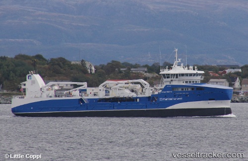
Vessel Gaso Freyja IMO: 9793662, MMSI: 257252000 Fish Carrier
UTC, 61.10936, 5.33988, course: 275, speed: 0
UTC, 61.10934, 5.33985, course: 275, speed: 0
2026-01-18 06:42:32 UTC, 61.10793, 5.33692, course: 268, speed: 1.3
Live AIS position:
UTC. Near Leirvik i Hyllestad),
updated 2026-01-18 06:42:32 UTC.
Find the position of the vessel Gaso Freyja on the map. The latter are known coordinates and path.
marine traffic ship tracker show on live map
The current position of vessel Gaso Freyja is 61.10793 lat / 5.33692 lng. Updated: 2026-01-18 06:42:32 UTCCurrently sailing under the flag of Norway
Details:
Last coordinates of the vessel:
UTC, 61.10936, 5.33975, course: 284, speed: 0UTC, 61.10936, 5.33988, course: 275, speed: 0
UTC, 61.10934, 5.33985, course: 275, speed: 0
2026-01-18 06:42:32 UTC, 61.10793, 5.33692, course: 268, speed: 1.3