 vesseltracker.com
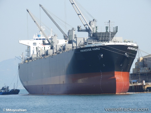
Vessel Princess Haru IMO: 9801237, MMSI: 538007472 Wood Chips Carrier
UTC, 25.73488, 133.44608, course: 193, speed: 13.4
UTC, 25.42961, 133.37454, course: 186, speed: 13.7
2026-01-19 04:05:32 UTC, 25.32515, 133.35771, course: 192, speed: 13.9
Live AIS position:
UTC. 117 nm E of Kitadaito Apt),
updated 2026-01-19 04:05:32 UTC.
Find the position of the vessel Princess Haru on the map. The latter are known coordinates and path.
marine traffic ship tracker show on live map
The current position of vessel Princess Haru is 25.32515 lat / 133.35771 lng. Updated: 2026-01-19 04:05:32 UTCDetails:
Last coordinates of the vessel:
UTC, 25.86800, 133.47435, course: 192, speed: 13.2UTC, 25.73488, 133.44608, course: 193, speed: 13.4
UTC, 25.42961, 133.37454, course: 186, speed: 13.7
2026-01-19 04:05:32 UTC, 25.32515, 133.35771, course: 192, speed: 13.9