 vesseltracker.com
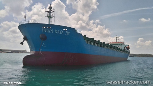
Vessel Intan Daya 288 IMO: 9829954, MMSI: 525100906 General Cargo Ship
UTC, -7.21369, 114.89741, course: -1, speed: 3.9
UTC, -7.21369, 114.89741, course: -1, speed: 3.9
2026-01-18 05:12:22 UTC, -7.21369, 114.89741, course: -1, speed: 3.9
Live AIS position:
UTC. 31 nm SW of Arjasa),
updated 2026-01-18 05:12:22 UTC.
Find the position of the vessel Intan Daya 288 on the map. The latter are known coordinates and path.
marine traffic ship tracker show on live map
The current position of vessel Intan Daya 288 is -7.21369 lat / 114.89741 lng. Updated: 2026-01-18 05:12:22 UTCCurrently sailing under the flag of Indonesia
Details:
Last coordinates of the vessel:
UTC, -7.21369, 114.89741, course: -1, speed: 3.9UTC, -7.21369, 114.89741, course: -1, speed: 3.9
UTC, -7.21369, 114.89741, course: -1, speed: 3.9
2026-01-18 05:12:22 UTC, -7.21369, 114.89741, course: -1, speed: 3.9